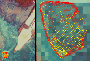
 Survey:
Lower Phillips Creek Topographic Survey 1994
Survey:
Lower Phillips Creek Topographic Survey 1994Collection Date(s): 4June1994 - 30Sept1994
Collectors: Benjamin Clark, Trine Christiansen, Shannon Hunter, Tim Wisecarver
Contacts: Trine Christiansen, Dave Richardson, Pat Wiberg
Number of Survey Points: 833
Resolution: 5 m., finer around creek banks and ponds, rougher in northern half
Collected Data: x and y UTM coordinates, elevation.

Online Data Formats:
Click Here for Full Metadata, including collection methods, accuracy reports, and codeset descriptions.
To download geographic dataset, select format below,