Atlas of Remotely-Sensed Images of the Virginia Coast Reserve LTER
Contents
Thematic Mapper Images : rectified / unrectified / on tapeAerial Photos : rectified / unrectified / on transparent film
SPOT Images
Rectified coordinates are UTM zone 18 NAD27 from ground control point coordinates off USGS quads.
Unless otherwise noted, these images are stored offline on optical disks for use by LTER researchers under negotiated liscense agreements with the providing agency or company. To obtain copies of the raw images, contact John Porter and include the name and location of the file.
Manipulated imagery and air photos that are publically available online have links provided. Some of these GIF images are also available in POSTSCRIPT versions available through the VCR Gopher.
All thumbnails and available imagery is subject to the VCR-LTER data management policy.
Thematic Mapper Image Archiving
Rectified
| Thumbnail | File Name | Stogage Optical | Description | Other Close-Up GIFs | Close-Up Notes |
|---|---|---|---|---|---|
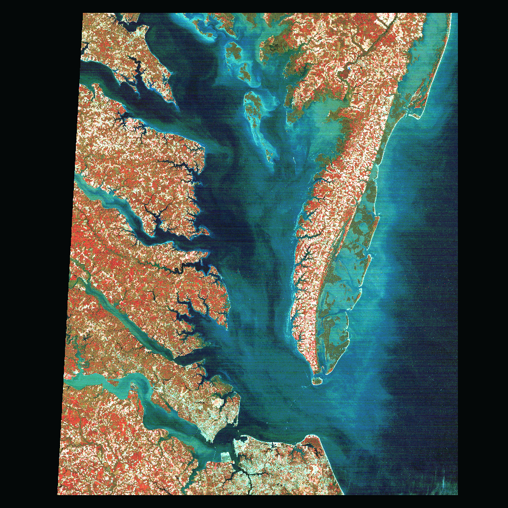
| tm93_r30 |
14-B | Rectified Delmarva Penninsula subset of full tm930728. |
|
A.) 1993 TM bands 4,5,2 of Hog to Cobb Island. B.) 1993 TM bands 4,5,2 of Wreck to Smith Island. |

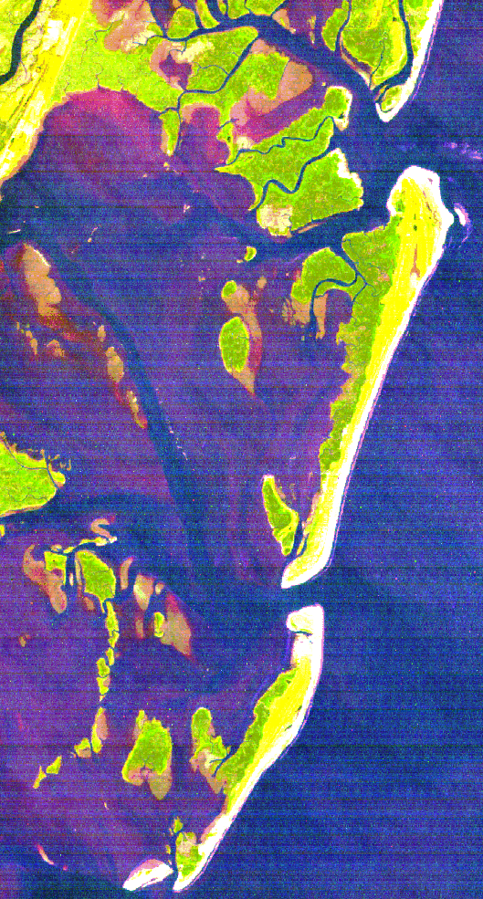
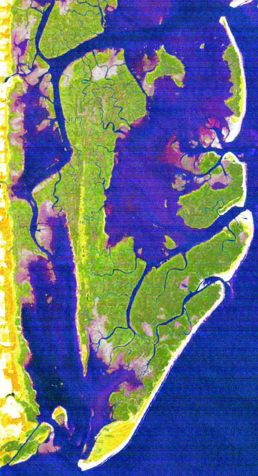
| hbay930728n83fx | L07-B | Rectified Hog Island Bay subset of tm93_r30, UTM coordinates to NAD83 datum (Oertel). | ||

| hbay930712n83fx | L07-B | Rectified Hog Island Bay subset of tm930712, UTM coordinates to NAD83 datum (Oertel). *includes gcp and cfn points for use in rectifying original TM. | ||

| hbay920810n83fx | L07-B | Rectified Hog Island Bay subset of tm920810, UTM coordinates to NAD83 datum (Oertel). *includes gcp and cfn points for use in rectifying original TM. | ||

| hbay920115n83fx | L07-B | Rectified Hog Island Bay subset of tm920115, UTM coordinates to NAD83 datum (Oertel). *includes gcp and cfn points for use in rectifying original TM. | ||
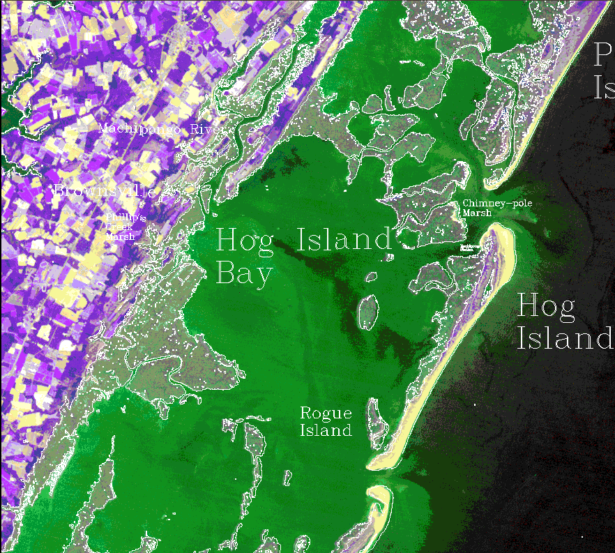
| hogcobb | L09-A | Rectified subset of Hog and Cobb Islands and their backbarrier lagoons and marshes? 1993? | |||
| parr90 | 2-B | Subset of 1990? TM scene. Rectified? TM? | |||

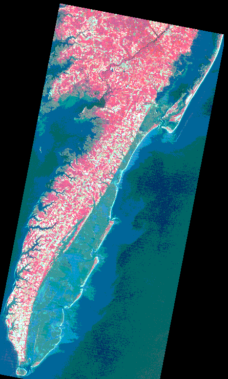
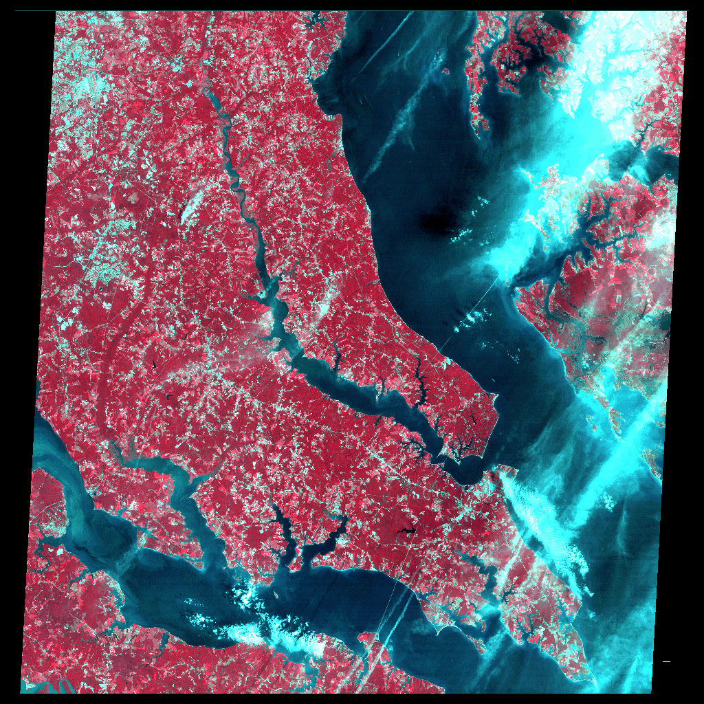
| delmartmra86 | L2-B | Delmarva Penninsula subset of full tm scene from summer 1986. Rectified. |
|
A.) Hog Is., Hog Is. Bay & surrounding areas --w/ outlines. B.) Hog Is. & Hog Is. Bay showing shoals and marshes (30m res). |

| hbay86n83fx | L07-B | Rectified Hog Island Bay subset of delmartmra86, UTM coordinates to NAD83 datum (Oertel). | ||
| parrtm86 | L09-A | Parramore Island subset of Delmarva Penninsula subset of full tm scene from summer 1986. Rectified. Used for initial land cover classification/change analysis of Parramore86-91, dlr2n. | |||
| delmartmr | 2-B | Delmarva Penninsula subset of full tm scene from ????. Rectified. |
Thematic Mapper Image Archiving
Unrectified
| Thumbnail | File Name | Stogage Optical | Description |
|---|---|---|---|

| tm930728 | 14-B | Unrectified Delmarva Penninsula subset of full tm930728. |
| tm930712 | L07-A | Unrectified. **L07-B : hbay930712 includes gcp and cfn points for use in rectifying original TM. | |
| tm920810 | L2-B | Delmarva Penninsula subset of full tm920810 (from 10 August 1992). Unrectified. **L07-B : hbay920810 includes gcp and cfn points for use in rectifying original TM. |

| tmdelm920115 | L2-B | Delmarva Penninsula subset of full tm920115 (from 15 January 1992). Unrectified. **L07-B : hbay920115 includes gcp and cfn points for use in rectifying original TM. |
| tm84q2md | 2-A | Unrectified quarter TM scene 1984 of SE portion of Maryland west of Chesapeake Bay. |
| b67 | 2-A | Unrectified?? |
Thematic Mapper Image Archiving
Original Unrectified TM scenes on Digital Tape
| Thumbnail | File Name | Stogage Optical | Description |
|---|---|---|---|
| tm081092 | tape | Unrectified. Bands 1-7. Aug 10 1992. | |
| tm061093 | tape | Unrectified. Bands 1-7. June 10 93. | |
| tm071293 | tape | Unrectified. Bands 1-7. July 12 1993. | |
| tm072893 | tape | Unrectified. Bands 1-7. July 28 1993. |
SPOT Image Archiving
| Thumbnail | File Name | Stogage Optical | Description |
|---|---|---|---|
| 626274 | L2-A | SPOT image. Unrectified? | |
| 626275 | L2-A | SPOT image. Unrectified? | |
| sdels89r | L2-A | SPOT image. Rectified? | |
| spotpana | L2-A | SPOT image. Rectified? | |
| 620274 | 2-B | SPOT image. Rectified? | |
| 621274 | 2-B | SPOT image. Rectified? |
Digitally-Scanned Aerial Photo Archiving
Rectified
| Thumbnail | File Name | Stogage Optical | Description | Other Close-Up GIFs | Close-Up Notes |
|---|---|---|---|---|---|
| ???hog91a | ??? | Composite false-color infrared aerial photo (1:20000) of north Hog Island, 1991. 5 meter? resolution. Rectified. | ||

| ???hog89a | ??? | Composite false-color infrared aerial photo (1:20000) of north Hog Island, 1989. 5 meter? resolution. Rectified. | ||
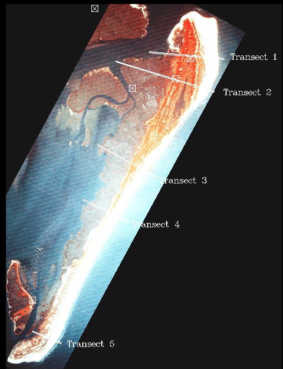
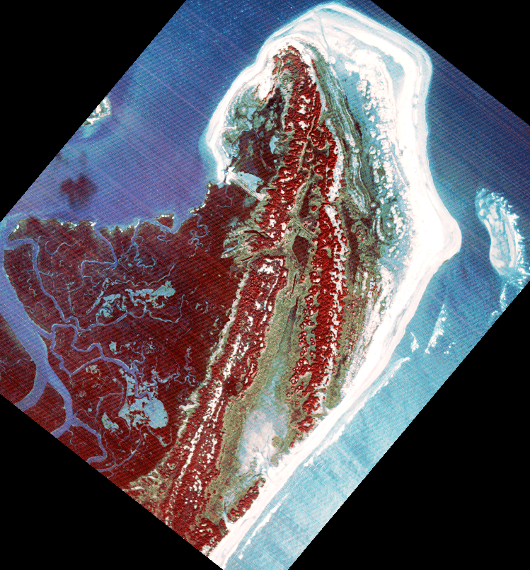
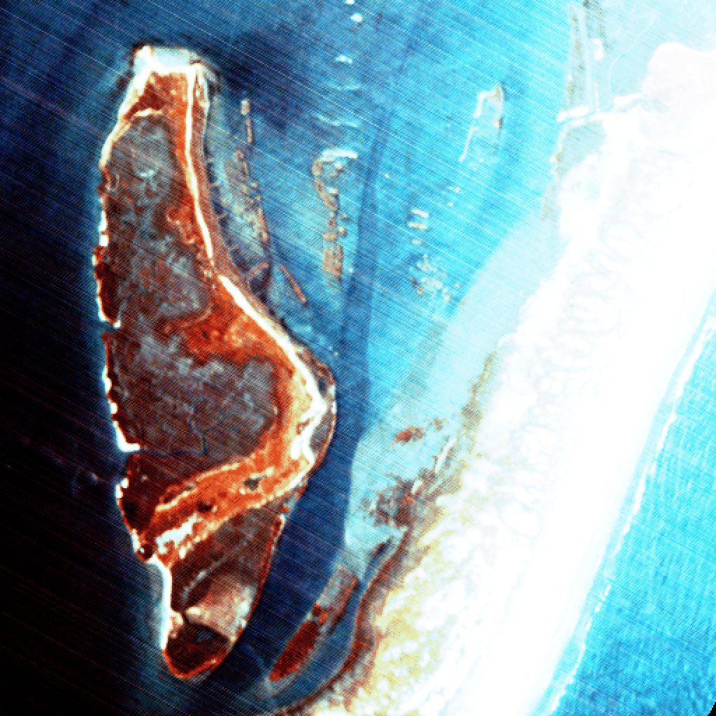
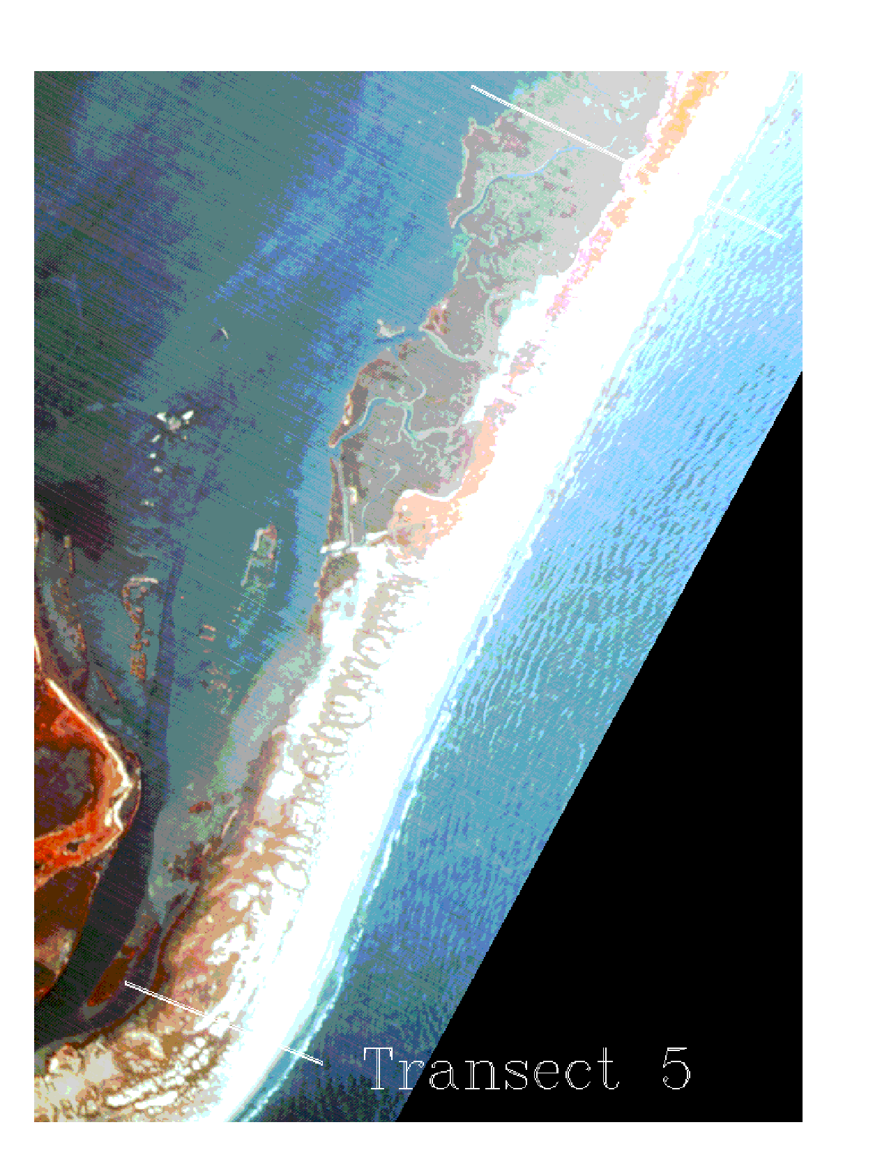
| hog90r5 | ??? | Composite false-color infrared aerial photo (1:68000) of Hog Island, 1990. 5 meter? resolution. Rectified. (GIF shows locations of small mammal transects.) |

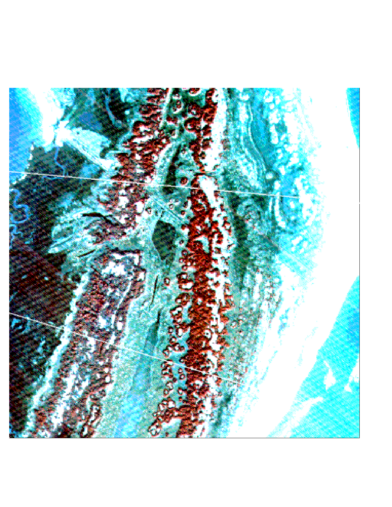
|
A.) Contrast-stretched regions of Hog Island 1990 showing dunes,
swale marsh, and shrubs. [N->S
1 ..
2 ..
3 ..
4 ..
Rogue ]
Also avail: ZIPPED file of above in TIFF format (5M zipped). |
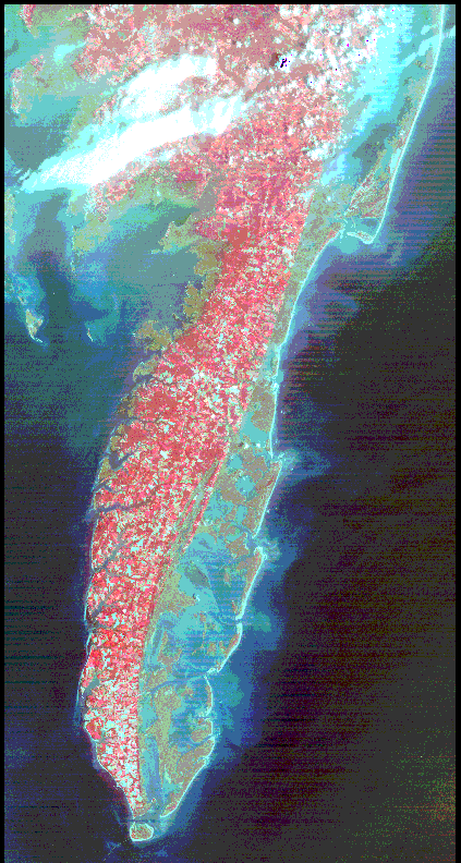
| parr91r5 | L6-A | Composite false-color infrared aerial photo (1:20000) of Parramore Island, 1991. 5 meter resolution. Rectified. |
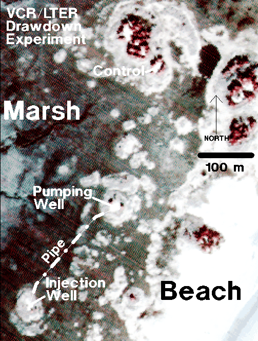
| A.) Aerial Photo and Map of VCR/LTER Drawdown Experiment (Parramore Is.) |
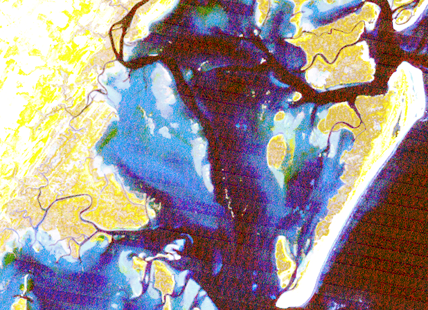
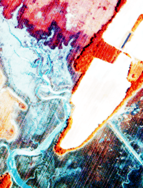
| philcrk90r3 | 2-B | False-color infrared aerial photo of Phillips Creek, 1990. 3 meter resolution. Rectified. |

|
A.) Enlarged view. B.) Analysis showing `Green-ness', `Wetness' & `Brightness'. | |
| philcrk90r3a | 2-B | False-color infrared aerial photo of Phillips Creek, 1990. 3 meter resolution. Rectified. |
Digitally-Scanned Aerial Photo Archiving
Unrectified
| Thumbnail | File Name | Stogage Optical | Description | Other Close-Up GIFs | Close-Up Notes |
|---|---|---|---|---|---|

| ??? | ??? | False-color infrared aerial photo of Oyster, VA, 1989. 3 meter resolution?. Unectified. rectification cfns and gcps to NAD27 included |

|
A.) Enlarged rectified (NAD83) view of Oyster Harbor. |
| philc | 2-B | False-color infrared aerial photo of Phillips Creek, 1990. 3 meter resolution. Unrectified. | |||
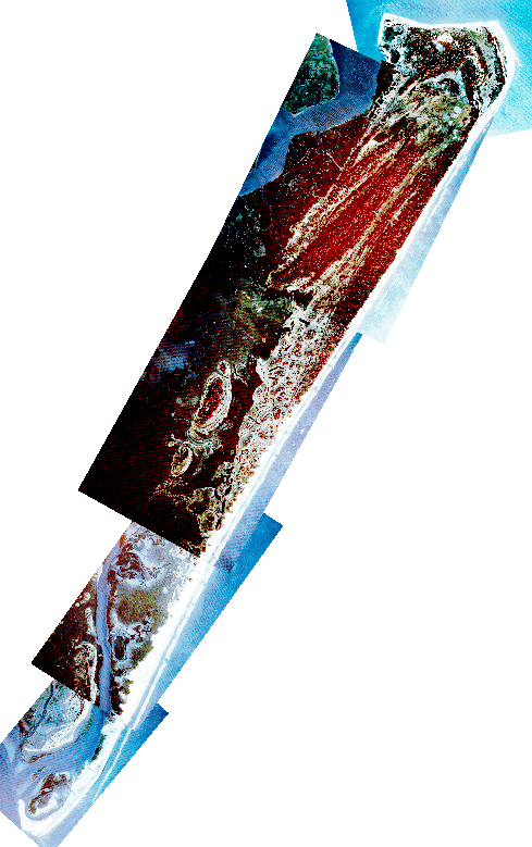
| hog91a, hoga1291 | 14-B, 12-B, 2-A | Unrectified false-color infrared aerial photo of Hog Island, 1991. Ordered north to south. | |||
| hog91b, hogb1291 | 14-B, 12-B, 2-A | Unrectified false-color infrared aerial photo of Hog Island, 1991. Ordered north to south. | |||
| hog91c, hogc1291 | 14-B, 12-B, 2-A | Unrectified false-color infrared aerial photo of Hog Island, 1991. Ordered north to south. | |||
| hog91d, shog1291 | 14-B, 2-A | Unrectified false-color infrared aerial photo of Hog Island, 1991. Ordered north to south. | |||
| parr91a | 12-B | Unrectified false-color infrared aerial photo of Parramore Island, 1991. Ordered north to south. | |||
| parr91b | 12-B | Unrectified false-color infrared aerial photo of Parramore Island, 1991. Ordered north to south. | |||
| parr91c | 12-B | Unrectified false-color infrared aerial photo of Parramore Island, 1991. Ordered north to south. | |||
| parr91d | 12-B | Unrectified false-color infrared aerial photo of Parramore Island, 1991. Ordered north to south. | |||
| parr91e | 12-B | Unrectified false-color infrared aerial photo of Parramore Island, 1991. Ordered north to south. | |||
| parr74a | 2-B | Unrectified? false-color infrared aerial photo of Parramore Island, 1974. Ordered north to south. | |||
| parr74b | 2-B | Unrectified? false-color infrared aerial photo of Parramore Island, 1974. Ordered north to south. | |||
| parr74c | 2-B | Unrectified? false-color infrared aerial photo of Parramore Island, 1974. Ordered north to south. | |||
| parramore1989 | 2-B | Unrectified? false-color infrared aerial photo? of Parramore Island, 1989. | |||
| cobb91a | 14-A, 12-A | Unrectified false-color infrared aerial photo of Cobb Island, 1991. Ordered north to south. | |||
| cobb91b | 14-A | Unrectified false-color infrared aerial photo of Cobb Island, 1991. Ordered north to south. | |||
| cobb91c | 14-A | Unrectified false-color infrared aerial photo of Cobb Island, 1991. Ordered north to south. | |||
| myrtle91a | 14-A | Unrectified false-color infrared aerial photo of Myrtle Island, 1991. Ordered north to south. | |||
| myrtle91b | 14-A | Unrectified false-color infrared aerial photo of Myrtle Island, 1991. Ordered north to south. | |||
| myrtle91c | 14-A | Unrectified false-color infrared aerial photo of Myrtle Island, 1991. Ordered north to south. | |||
| myrtle91d | 14-A | Unrectified false-color infrared aerial photo of Myrtle Island, 1991. Ordered north to south. | |||
| ship91a | 14-A | Unrectified false-color infrared aerial photo of Shipshoal Island, 1991. Ordered north to south. | |||
| ship91b | 14-A | Unrectified false-color infrared aerial photo of Shipshoal Island, 1991. Ordered north to south. | |||
| wreck91a | 14-A | Unrectified false-color infrared aerial photo of Wreck Island, 1991. Ordered north to south. | |||
| wreck91b | 14-A | Unrectified false-color infrared aerial photo of Wreck Island, 1991. Ordered north to south. | |||
| cedar91a | 12-B | Unrectified false-color infrared aerial photo of Cedar Island, 1991. | |||
| cedar91b | 14-B | Unrectified false-color infrared aerial photo of Cedar Island, 1991. | |||
| cedar91c | 12-B | Unrectified false-color infrared aerial photo of Cedar Island, 1991. | |||
| assaw91a | 12-A | Unrectified false-color infrared aerial photo of Assawoman Island, 1991. Ordered north to south. | |||
| assaw91b | 12-A | Unrectified false-color infrared aerial photo of Assawoman Island, 1991. Ordered north to south. | |||
| assaw91c | 12-A | Unrectified false-color infrared aerial photo of Assawoman Island, 1991. Ordered north to south. | |||
| metom91a | 12-A | Unrectified false-color infrared aerial photo of Metompkin Island, 1991. Ordered north to south. | |||
| wallop91a | 12-B | Unrectified false-color infrared aerial photo of Wallops Island, 1991. Ordered north to south. | |||
| wallop91b | 12-B | Unrectified false-color infrared aerial photo of Wallops Island, 1991. Ordered north to south. | |||
| wallop91c | 12-A | Unrectified false-color infrared aerial photo of Wallops Island, 1991. Ordered north to south. | |||
| wallop91d | 12-A | Unrectified false-color infrared aerial photo of Wallops Island, 1991. Ordered north to south. | |||
| wallop91e | 12-A | Unrectified false-color infrared aerial photo of Wallops Island, 1991. Ordered north to south. |
Unscanned Aerial Photo Archiving
on transparent film
| Thumbnail | File Name | Stogage Optical | Description |
|---|